Understanding existing site conditions is one of the most important steps in any development, infrastructure, construction, or land management project. Modern drone aerial surveys provide project teams with a broader perspective of a property while supporting accurate mapping, planning, and documentation efforts. Austin Engineering provides drone and aeriel surveys you need for better planning.
At Austin Engineering, drone technology is not treated as a standalone service or photography tool. Instead, it serves as an extension of our professional land surveying capabilities. By combining drone surveying services with established survey control, field verification, and professional oversight, we help clients collect valuable site information efficiently while maintaining the accuracy required for engineering, design, and construction decisions.
Drone-based data collection can be especially valuable on large properties, active construction sites, agricultural land, solar developments, infrastructure corridors, and locations where traditional ground access may be challenging. When integrated with traditional surveying methods, aerial mapping services can provide detailed visual and spatial information that supports planning, design, permitting, construction coordination, and project documentation.
Whether you’re evaluating a development site, documenting construction progress, planning a solar installation, or gathering information for future engineering work, Austin Engineering provides drone mapping and surveying solutions that fit within a comprehensive surveying strategy.

Every project begins with a clear understanding of the client’s goals. Our team evaluates the site, identifies project requirements, reviews existing survey information, and determines how aerial data collection can support the overall project.
This planning stage helps ensure that the survey approach aligns with engineering, development, construction, or documentation needs.
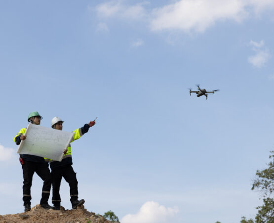
Accurate aerial data depends on accurate survey control. Before flight operations begin, our surveyors establish or verify control points that help tie aerial information to real-world coordinates.
This critical step distinguishes professional UAV surveying from simple drone photography. Survey control helps improve positional accuracy and allows aerial information to be integrated with other survey and design data.
Once site control is established, aerial data collection is performed using specialized drone technology and flight planning procedures.
Depending on project requirements, data collection may include:
These drone surveying services allow project teams to gather information across substantial areas efficiently while minimizing disruption to ongoing operations.
Following data collection, imagery and survey information are processed into usable project deliverables.
Depending on project objectives, this may include:
Our team reviews all processed data to ensure it aligns with project requirements and integrates appropriately with broader surveying and engineering efforts.
Final deliverables are reviewed and coordinated with project stakeholders. Data may support civil engineering design, land planning, construction coordination, landscape architecture, utility planning, or property development activities.
Because Austin Engineering offers surveying, engineering, and landscape architecture services, aerial data can be incorporated into a larger project workflow rather than existing in isolation.

Drone and aerial survey projects vary based on site conditions and project objectives. Depending on the scope of work, deliverables may include:
Because drone technology works best when paired with traditional survey practices, our team carefully evaluates how aerial information fits into each project’s broader surveying needs.
Several factors influence the scope, schedule, and cost of commercial drone surveying projects.
Larger properties generally require additional flight planning, data collection, and processing time.
Deliverables such as orthomosaic mapping, modeling, documentation, or engineering support can affect project requirements.
Vegetation, terrain, structures, utilities, and accessibility may impact data collection efforts.
Projects requiring extensive control networks or integration with other survey services may involve additional field work.
Projects involving engineers, contractors, municipalities, or multiple stakeholders often require additional review and coordination.
Austin Engineering works closely with clients to establish realistic timelines and ensure deliverables support project objectives.
Large tracts of land can be difficult and time-consuming to document exclusively through traditional field methods.
Drone land surveys provide an efficient way to capture aerial information across agricultural properties, rural developments, utility corridors, and expansive commercial sites. Combined with proper survey control, aerial data helps improve site understanding while supporting future planning efforts.
Many engineering projects benefit from comprehensive existing conditions information before design work begins.
Our drone photogrammetry services and aerial mapping capabilities can support:
Aerial information helps project teams visualize site conditions while supporting engineering and design workflows.
Drone technology is particularly valuable for projects involving extensive site coverage.
Applications may include:
These projects often benefit from regular aerial documentation throughout planning and construction phases.
Austin Engineering provides aerial mapping services, construction drone surveys, and related land surveying support through our offices in Peoria, Illinois and Davenport, Iowa.
311 SW Water Street, Suite 215
Peoria, IL 61602
(309) 315-3643
220 Emerson Place, Suite 101-A
Davenport, IA 52801
(563) 207-4605
Our team supports projects throughout Central Illinois, Eastern Iowa, the Quad Cities region, and surrounding service areas.
Drone technology is only as valuable as the accuracy behind it. Our team emphasizes proper survey control, field verification, and professional oversight to ensure aerial information supports informed project decisions.
Because Austin Engineering provides surveying, engineering, and landscape architecture services, aerial data can be coordinated directly with planning, design, and construction workflows.
From agricultural properties to development sites and infrastructure corridors, our team helps clients document large areas efficiently while maintaining project-specific accuracy requirements.
Founded in 1937, Austin Engineering brings decades of surveying and development experience to every project. Our approach combines modern technology with proven surveying practices to deliver dependable results.
Austin Engineering has supported public and private projects throughout Illinois and Iowa for generations. Clients rely on our team for accurate survey information, responsive communication, and professional project coordination.
Our long-standing relationships with developers, municipalities, contractors, property owners, and design professionals reflect our commitment to quality work and practical solutions.
No. Drone surveys complement traditional surveying methods but do not replace them. Accurate aerial mapping typically requires survey control and professional verification.
Common applications include site documentation, existing conditions review, development planning, construction progress monitoring, rural property mapping, and engineering support.
Yes. Construction drone surveys are frequently used to document site conditions, monitor progress, and support project coordination.
Absolutely. Drone technology is particularly effective for large developments, agricultural properties, solar facilities, and infrastructure corridors.
Accuracy depends on project requirements, survey control, processing methods, and field verification. Professional survey oversight is essential when aerial information is being used for design or development purposes.

Drone and aerial surveying often works alongside other land surveying services rather than replacing them.
Projects may combine aerial data collection with:
When integrated properly, aerial information can improve project understanding while supporting planning, engineering, permitting, and construction objectives.
Whether you’re evaluating a development site, documenting construction progress, planning infrastructure improvements, or managing a large rural property, Austin Engineering can help you collect accurate site information through professional drone surveying contractor services.
Contact our Peoria or Davenport office today to discuss your project and learn how drone and aerial surveys can support your broader land surveying and development goals.