The profession of land surveying has a long and storied history. From Ancient Egypt to modern times, the need for surveyors has always been there. However, in today’s modern age, we’ve developed more accurate and efficient methods for performing land surveys. As such, Austin Engineering has been leading the charge by implementing drone technology to provide as precise an estimate for your land as possible. Through our advanced surveying methods, we’ve become one of the most reliable surveying companies throughout Central Illinois. But what makes drones so unique, regarding surveying? Continue reading to learn more!
If you aren’t familiar with the land surveying profession, a quick explanation is it’s a central component to building, real estate and land ownership. Specifically, land surveying is when licensed surveyors perform a complete assessment of a piece of land. Depending on the extent of the surveying, we discover the land’s boundaries, topography, elevation, natural resources, elevation above ground level and more.
As far back as 1,400 B.C., land surveying was a common part of civilization. Often, surveying was done to determine the taxing of plots of land. However, in those days, land surveying wasn’t much more complicated than stretching a rope between two places and noting the length. And in Ancient Egypt, land surveying was utilized to measure out and level the land the Great Pyramids occupy.
Throughout the centuries, land surveyors developed more extravagant tools, so to increase the accuracy and range of their abilities. Innovations made by the Chinese, Greeks and Europeans led to the expansion of the surveying field to what it is today. There were even some important figures throughout history who were land surveyors themselves. William the Conqueror utilized surveying to create records of the plots of land he took in what was called the Domesday Book. Fast forward to the founding of our nation, and you’d be surprised to discover our very own George Washington and Thomas Jefferson were both land surveyors, too! Indeed, land surveying has played an essential role throughout history.
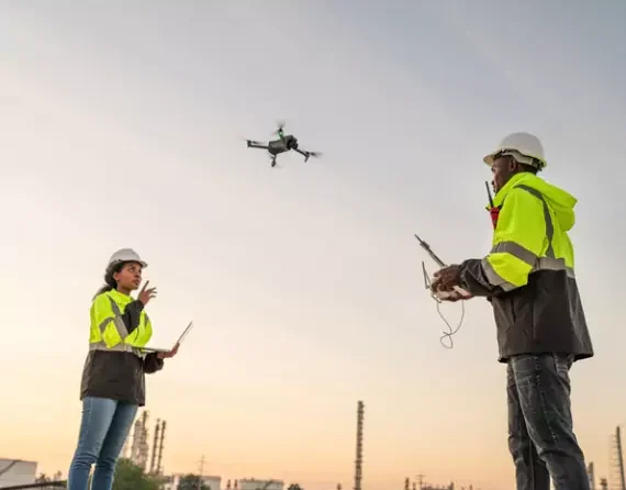
While it’s fun to reminisce on surveying practices of old, land surveyors have made incredible strides to make it to the point we are at today. Over the last several years, with the availability of drones coming to prominence, our land surveyors have begun using this unique tech to get a “lay of the land” better.
Surveyors equip drones with different sensors and cameras that help them take various measurements. A surveyor can then evaluate and decipher these measurements and pictures to create 2D and 3D orthomosaic maps, thermal maps, 3D models and more.
Drones allow professional surveying companies, like Austin Engineering, to provide their clients with a fuller picture of measurements for their property. Furthermore, drones allow faster implementation of surveying and can help cut down on costs. Some advantages to drone surveying include:
Austin Engineering, a leading civil engineering firm and land surveying company, can help you with your next surveying project. We possess two full-service survey teams to provide fast, efficient and comprehensive surveying of any kind. And, as we utilize drone technology ourselves, you know you are getting the most accurate survey possible. We have experience performing numerous survey projects throughout Central Illinois and several areas outside the state.
If you’re interested to see what our drones can do for you, give Austin Engineering a call today. You can contact our surveyor team at 309-204-0694. Also, our main office is located at 311 SW Water St, Ste 215, Peoria, IL 61602.