Are you trying to get a better “lay of the land” regarding the property you own? Whether you’re trying to determine boundaries, wish to begin new construction, or want to update an existing structure, knowing the finer details about the land being worked on is essential for successful project completion. Thankfully, finding the right team to perform a survey doesn’t have to be a challenge! Best of all, surveys have never been more accessible, thanks to the advancement of drones. Call the survey professionals at Austin Engineering, Co. to get started with drone surveys near Bettendorf, IA, and the Quad Cities.
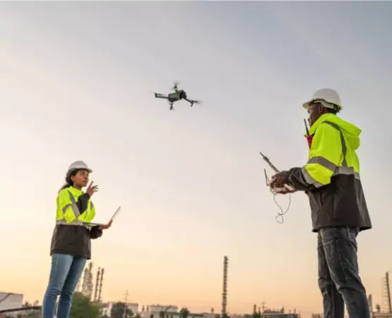
As survey methods have advanced, drones have become a popular tool for most civil engineering companies. While Austin Engineering still relies on traditional survey methods that use GPS receivers and ground-based equipment, drones have become increasingly prevalent in our survey operations. Simply put, drone surveys provide a faster, safer, and cheaper alternative to traditional survey methods. They also allow for high-quality aerial mapping, 3D modeling, and topographic surveys.
Besides enabling faster, safer, and more cost-effective surveying, drone surveys offer a range of additional benefits. Best of all, these benefits don’t just affect our surveyors; they directly impact you and the details of your project. Examples of some of the other advantages of drone surveys include:
Using drone surveys in Bettendorf, IA, Austin Engineering can provide our clients with a wealth of important information for their property. Whether you need to know about a property’s boundaries, determine its topography, mark what lies in a flood zone, etc., our drone surveys have the answer. Austin Engineering’s survey crew provides a wide variety of surveys, including:

Get all the data you could ever need for a piece of land, thanks to the efforts of Austin Engineering, Co. and our drone surveys for Bettendorf, IA. If you’d like to learn more about Austin Engineering and our additional services, including landscape architecture, site planning and development, call
563-207-4605. Our office is located at 220 Emerson Place, Ste 101-A, Davenport, IA 52801.